


Presentation
Avançon is a small village situated on a headland overlooking the Avance Valley, at an altitude of 936 metres, in the heart of the Hautes-Alpes department.
Population: 467 (2013)
Average altitude: 920 m
Area: 22.6 km²
Mayor: Mr Frédéric CAVALLINO
Residents: the men and women of Avançon
Surrounded by the towns of Montgardin, Saint-Étienne-le-Laus and La Bâtie-Neuve, Avançon is just 9 km from Gap, as well as from Lake Serre-Ponçon.
The Avançon plain. The commune covers an area of 22.6 km² and had a population of 412 according to the 2016 census.
It comprises three hamlets: the main village, Chaussenoire, Les Santons, and several localities comprising a few detached houses, the majority of which are farmsteads.
The village is one of the vertices of the triangle formed by the localities of Saint-Étienne-le-Laus and Notre-Dame-du-Laus. Avançon is the main village, home to the Church of Saint Gervais, built in 1563, the Chapel of Notre Dame de Pitié, the town hall, and the former village school, which has been converted into a multi-purpose hall and meeting room.
With a population density of 16.5 inhabitants per km², Avançon has seen a marked increase of 12.4 per cent in its population compared with 1999.
The River Avance and the Saint-Pancrace stream are the main watercourses flowing through the commune of Avançon. The commune is situated close to the Écrins National Park, approximately 11 km away.
See also
-
 Mairie de Montgardin4, Place Roger Mamo
Située en bordure de la RN94, à 20 minutes de Gap et 10 minutes du ...
-
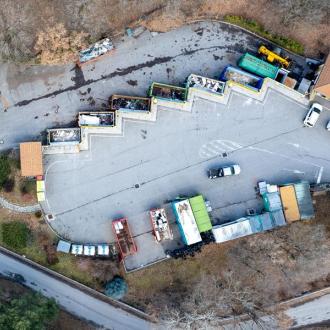 Déchèterie de l'AvancePlaine d'Avançon
La déchèterie est un service réservé aux particuliers et professionnels des 16 communes de la ...
-
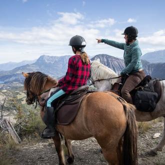 Le Tour de l'Avance à cheval
Cette randonnée vous mènera dans un écrin de verdure entre les berges de la Durance ...
-
 Mairie de La Bâtie-Neuve32, Place de la Mairie
Située à 10 minutes de Gap, à 15 minutes du lac de Serre-Ponçon, à 30 ...
-
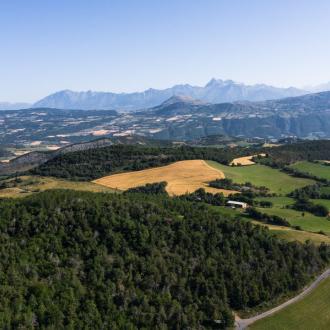 La Vallée de l'Avance
La Vallée de l’Avance est situé au sud des Hautes-Alpes, entre la Vallée de la ...


