Presentation
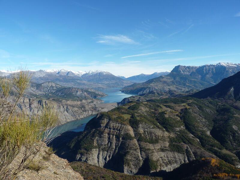
A sporty itinerary leading to the end of the Scie ridge to offer a 360 degree panoramic view. This is definitely the most unusual viewpoint on the dam and the Serre-Ponçon lake that nature can offer!
Cross the hamlet of Champsaurs and take the track on the left at the level of the crow's feet. Continue on this slightly uphill track. At the next intersection, continue to the left, in the direction of the Bois des Devins and the crête de la Scie
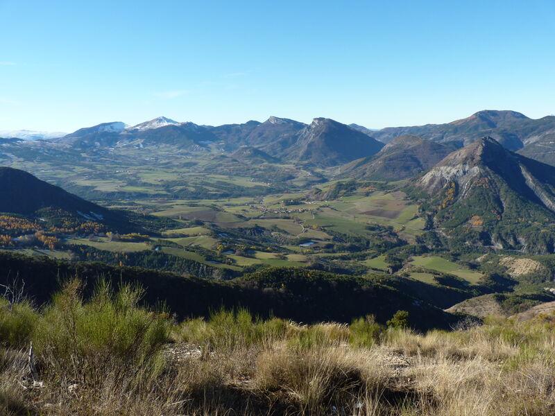
Leave the track leading to the Chapelle Saint Sixte on the left in favour of the ascending track on the right. Gradually enter the Devins wood, a pretty mixed forest, classified Natura 2000. Once you reach the pass, take the track on the left to walk along the Scie ridge to the Antenne. Views open up to the east, west and gradually north, offering beautiful panoramas of the surrounding mountains. The Blanche, the Ubaye, the Dévoluy and even the Ecrins can be discovered. Little by little, the unusual viewpoint of the dam is revealed to the most experienced eyes. Pass the water tank and continue towards the Antenne, taking care to avoid the steep ravines as you approach the Antenne. Then take the time to enjoy the view. Return to the pass by the same route. Back to the pass, the less adventurous can turn back. The more athletic are invited to go down to the left, in the Blanche valley, towards Champ du Pin and Gréolier. After a few hairpin bends, turn left onto the E6 track.
After a long stretch of nearly 4 km of forest track, leave it for a small path in the undergrowth, heading off to the left.
Turn again onto a forest track, at the Champ du Pin. Take it on the left towards Gréolier. Here again, a long section of track allows you to walk northwards. It ends up getting lost in a field
It becomes a nice wooded path, going down towards Gréolier. There is an unobstructed view of the dam, its compensation basin and the village of Espinasses, whose town planning bears witness to the history of the valley. This path then plunges into the Gorges ravine. Cross the ravine by passing above the big dam.
Once arrived on the left bank of the ravine, go down towards Gréolier by a farm track in the middle of the orchards until the tarred road. Leave the road and take a wooded path to the left, towards the hamlet of Beaufort. This pretty path crosses different environments: from wet undergrowth to dry scree. Once you have reached the hamlet of Beaufort, cross it and continue on the paved road for about 500 m. Turn left and resume the ascent towards the Saint-Sixte chapel along the botanical path. The path, always ascending, sometimes steep, crosses two gullies to reach the pass
From the pass, it is possible to go up to admire the panorama of the Chapelle Saint Sixte, about 10 minutes round trip. Alternatively, cross the fence and walk across the field towards Bréziers. Join a stony track at the end of the clearing and follow it to the hamlet of Les Achards. Shortly after leaving the hamlet, at the crossroads, turn right towards Les Champsaurs and return to the starting car park.
IGN map Gap n°3338ETCThis itinerary is part of the Plan Départemental des Itinéraires de Promenade et de Randonnée.
Difficulty = Difficult
Rates
Free of charge.

